Park Feature - Stirling Range National Park
This article appeared in LANDSCOPE magazine Autumn 2024.
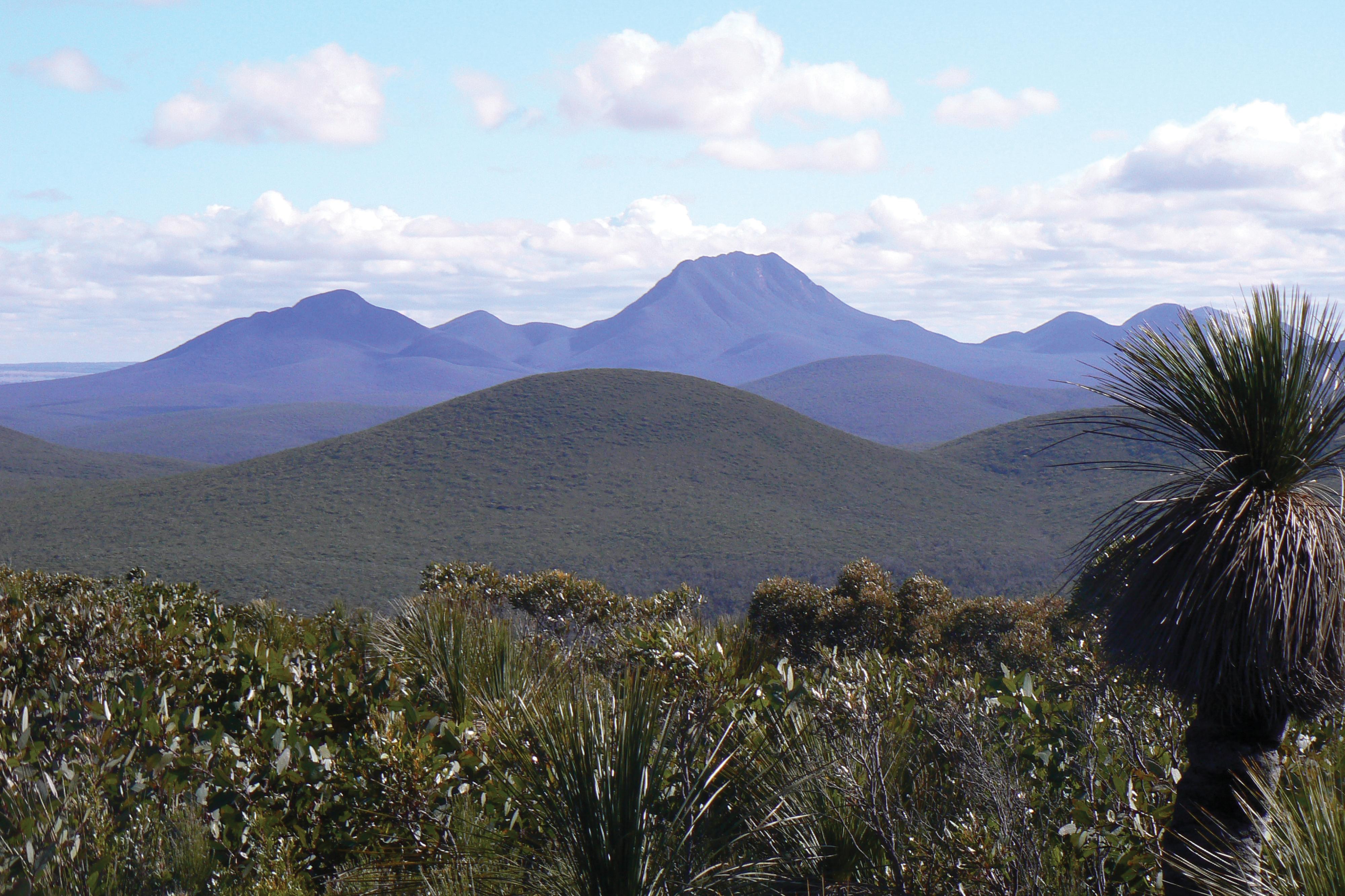
Around 80 kilometres north of Albany lies Stirling Range National Park, so named after the rugged peaks of the Stirling Range that mark the landscape with their impressive size and jagged edges.
The Aboriginal name for the range is Koi Kyenunu-ruff, which means ‘mist rolling around the mountains’; a frequent sight.
Many visitors flock to Stirling Range National Park for the challenge of climbing the highest peak in the south-west of Western Australia, Bluff Knoll, which rises 1095 metres above sea level creating a challenging and spectacular hiking experience. The surrounding range draws others to the brooding mountain landscape that comes alive in the spring with a stunning display of unique wildflowers.
The range stretches east-west for more than 65 kilometres and is characterised by stark cliff faces, magnificent views and abundant, vibrantly coloured flowering plants. At any time of year, there will always be some plants in bloom in the park and the Stirling Range is one of the few places in WA where snow occasionally falls.
Cultural history
The Mineng and Goreng Noongar Aboriginal peoples originally lived in and around the Stirling Range and surrounding Country. In cold weather, they built small, conical huts and wore kangaroo skin cloaks reaching nearly to the knee.
The lowlands surrounding the peaks were once important sources of food for Noongar peoples. Women gathered roots, seeds and fruit while men hunted kangaroos, wallabies and other animals.
When European settlers arrived they took up land, created farms and raised livestock. The area was declared a national park in 1913, at a time when the dominant practice leaned towards clearing the bush and converting it to farmland.
Displaced from their traditional land, many Noongar people worked on farms and lived on settlements or in missions.
Depending on the intent of the speaker, Bluff Knoll is called Bular Mial (‘many eyes’) or Bala Mial (‘his eyes’) by Noongar people. This was because they believed the rocks on Bluff Knoll were shaped like faces.
The peak is often covered by mists, which curl around the mountain tops and float into the gullies. These constantly changing mists were believed to be the only visible form of a spirit called Noatch, who had an evil reputation.
Bluff Knoll continues to be of great spiritual significance to Aboriginal peoples of the south-west as they believe it is home to a powerful ancestral being.
Plant life
The Stirling Range area is in the Southwest Australian Floristic Region that is internationally recognised as one of the world’s top 35 hotspots for biodiversity, receiving Australia’s highest heritage honour in 2006 when it was added to the National Heritage List.
The cloud-touched peaks, sheltered valleys, exposed rock faces, moist gullies, windswept lowlands and protected crevices of the range provide countless combinations of altitude, soil, rainfall, sunlight and exposure, enabling more than 1500 species of flowering plants to exist there.
More than eighty species of plants are endemic to the range and the park is particularly rich in banksias, eucalypts, orchids and verticordias (feather flowers).
The landscape displays a mosaic of thicket, mallee-heath, woodland and wetland habitats plus a unique and threatened ‘montane’ plant community found only on the tops of the high peaks.
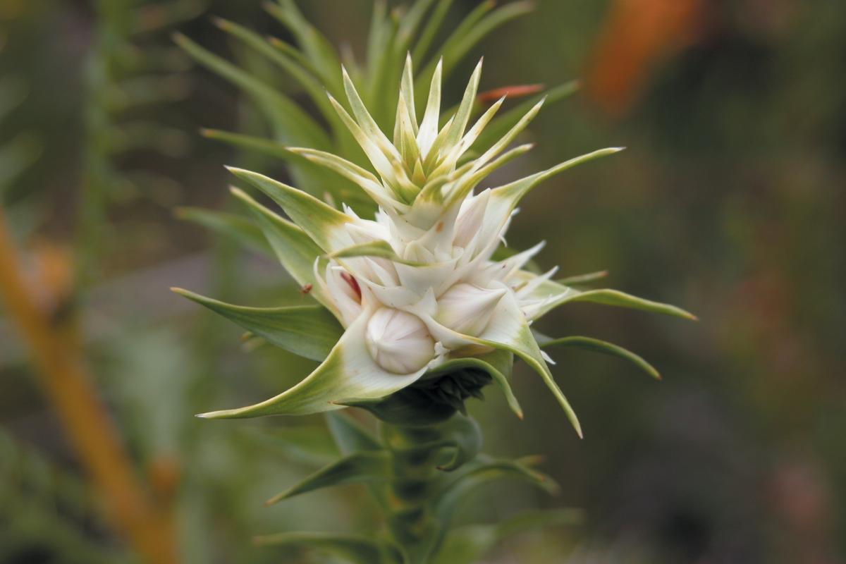
Among the most beautiful and iconic of the plants are the darwinias, or mountain bells. Nine species of mountain bell have been identified in the park and only one of these is found outside Stirling Range.
Phytophthora dieback is a major problem in the Stirling Range. Caused by a microscopic water mould that dwells in the soil, this plant pathogen kills plants by rotting their roots.
Dieback threatens biodiversity by not only killing plants but also by destroying wildlife habitat, placing the health and survival of whole ecosystems at risk.
Animal life
Nearly 150 bird species have been sighted in the park including the western rosella (Platycerus icterotis), red-capped parrot (Purpureicephalus spurius), western whistler (Pachycephala fuligonosa), splendid fairy-wren (Malurus splendens), wedge-tailed eagle (Aquila audax) and western spinebill (Acanthorhynchus superciliosus).
The most commonly spotted native mammals are the western grey kangaroo (Macropus fuliginosus) and western brush wallaby (Notamacropus irma). With luck, you may see a quokka (Setonix brachyurus) or a quenda (Isoodon fusciventer).
Reptiles, amphibians and invertebrates are plentiful including endemic and threatened invertebrates. Spiders, snails and earthworms survive in cool moist refuges between the peaks. Venomous snakes such as tiger snakes (Notechis scutatus) and dugites (Pseudonaja affinis) are present but rarely seen.
Geology
More than a billion years ago, a shallow sea covered the area. Minerals, soil, sand and the bones of tiny sea creatures slowly drifted down through the water to form ayer upon layer of sediment, transformed into layers of rock by the pressure created from their own weight. Ripple marks can still be seen on exposed rock layers on the peaks showing compacted layers of sediment.
Massive forces created by the Australian continent colliding with other continents eventually caused the rocks to buckle and rise. Chester Pass and Red Gum Pass show the course of rivers that flowed south during the early stages of the range’s formation.
The weathering forces of wind, rain, heat and cold steadily worked to erode the range into the jagged shape visitors can see today.
Do it yourself
- Where is it? 80 kilometres north of Albany or 400 kilometres south-east of Perth.
- Total area: 115,920 hectares
- Best time to visit: Late spring and early summer (October to December) when the days become warmer, and wildflowers are at their peak. Winter (June to August) is often cold and wet but can also offer crisp sunny days.
- Things to do: Camping, bushwalking and adventure activities.
- Staying safe in the park: Prepare for all weather as conditions may change unexpectedly. Carry and drink plenty of water - one litre per person per hour per day. Wear boots or other sturdy footwear and take extra care near rock edges.
- Nearest Parks and Wildlife Service office 120 Albany Highway, Albany, (08) 9842 4500.

